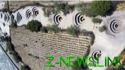
 Scientists have long assumed that the spiral lines on the Nazca plateau was, in ancient times aqueducts.
Italian archaeologists have uncovered with the help of satellite images the mystery craters on the Nazca plateau in Peru, which is the so-called “Nazca lines”.
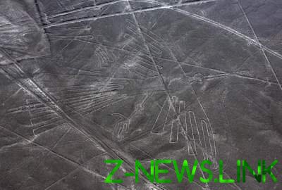
Nazca is known for its enigmatic drawings. It is believed that the ancient lost civilization of Nazca has created more than 30 giant images of plants and animals, hundreds of abstract geometric figures and 13 thousand lines, many of which are visible from space. All facilities are located on a desert high plateau of Nazca length of 70 kilometers.
Scientists have long assumed that the spiral lines on the Nazca plateau, ending funnels (called puquios, from Spanish “spring”, “source”), was in ancient times aqueducts. However, only using satellite images managed to figure out how it worked the mechanism of extraction of water.
According to experts, the hydraulic system was created “for extraction of water from underground aquifer”. Through these aqueducts of Nazca civilization was able to constantly get water in the area, which was dominated by drought.
The system of canals distributes water to areas where it was needed, the surplus remained in the reservoirs. Holes in the ground were needed to the irrigation system did the wind, which helped to drive away the water, scientists say.
“It is obvious that the system of sources had to be much more developed than what has reached our days,” conducts bi-Bi-si words of Rose Lasaponara of the Italian Institute of methods of environmental analysis (Institute of Methodologies for Environmental Analysis).

© 2017 – 2019, paradox. All rights reserved.


